Table of Contents
Overview
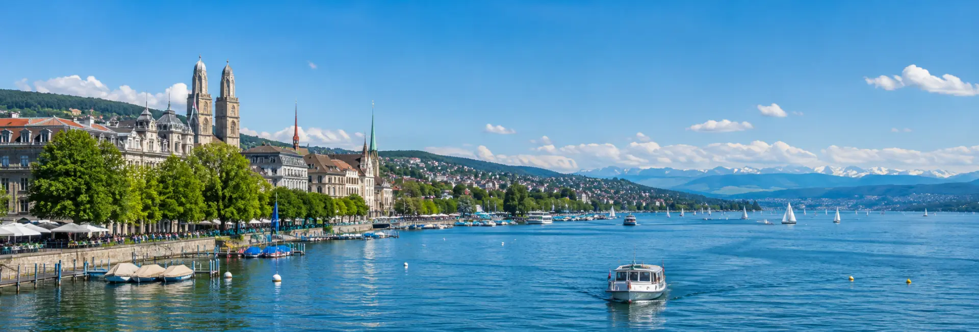
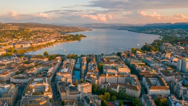
Lake Zurich, known locally as the Zürichsee, stretches southeast from the city center for roughly 40 kilometers, narrowing gradually as it runs toward the town of Rapperswil and beyond into its smaller upper arm, the Obersee. Within the city itself, the lake's northern tip forms the backdrop to Bürkliplatz and the Seefeld quay, where locals swim, sail, and stroll along tree-lined promenades just steps from the Old Town.
Beyond the city, the shoreline is lined with vineyard-covered hills, lakeside villages, and grand 19th-century villas, particularly along the so-called Gold Coast on the eastern bank. The lake functions as both a scenic backdrop and an everyday recreation ground, drawing residents for a lunchtime swim as readily as it draws visitors for a scenic boat cruise.
Unlike many alpine lakes reached only after a long drive or train ride, Zurich's lake begins essentially at the doorstep of the city, so a stretch of open water and distant Alpine peaks is visible from the same streets as the Old Town's church towers and shopping boulevards. That immediacy shapes how both residents and visitors use the lake, treating it less as a distant excursion and more as an extension of daily city life.
Formation / Natural History
Lake Zurich is a glacial lake, carved out by the Rhine-Linth glacier during the last Ice Age and later filled as the ice retreated and meltwater settled into the deepened valley floor. Its main tributary, the Linth, still feeds the lake from the Glarus Alps to the south before draining out at the city's edge as the Limmat River, which in turn flows on to join the Aare and eventually the Rhine.
The lake covers roughly 88 square kilometers, with a maximum depth of about 136 meters and an average depth of around 49 meters, sitting at an elevation of 406 meters above sea level. Water entering at the upper end takes well over a year on average to work its way through the lake and out at Zurich, a slow turnover that helps keep the water notably clear for a lake bordering a major city.
A glacial moraine forms a natural narrowing near Rapperswil, separating the smaller upper section, the Obersee, from the larger main body of the lake. This moraine sits close enough to the surface that the lake has occasionally frozen over in exceptionally cold winters, most recently in the early 1960s, an event rare enough to draw crowds onto the ice when it happens.
Flora & Fauna
The lake's clear, cold water supports populations of whitefish, perch, and trout, historically an important local food source and still fished commercially and recreationally today. Reed beds, bogs, and fens survive in protected pockets along quieter stretches of shoreline, particularly around the Obersee, providing habitat that has largely disappeared from the more developed sections closer to the city.
Water quality has improved considerably since the mid-20th century, when sewage discharge left parts of the lake nutrient-heavy and prone to algae blooms. Decades of treatment upgrades have since made the water clear enough that some stretches now support less algae than before, a shift that in turn changed which fish and bottom-dwelling species thrive there today.
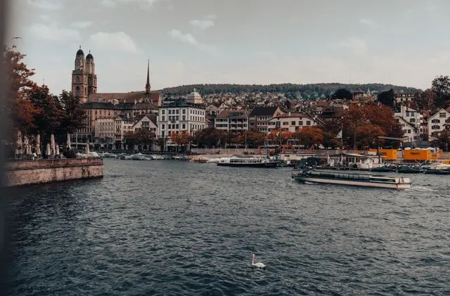
- Mute swans, a familiar and sometimes territorial presence around the city's quays
- Great crested grebes, grey herons, and various duck species year-round
- Seasonal visitors such as red-crested pochards and red-necked grebes in winter
- Vineyards climbing the hillsides above the eastern shore, notably around the Au peninsula
Key Areas / Villages
The City Shore and Seefeld
Closest to the Old Town, the lake's northern tip is framed by Bürkliplatz, the main boat departure point, and the Seefeld quarter's lakeside promenade, home to public gardens, lidos, and views back toward the city skyline and distant Alps.
The Gold Coast
The lake's northeastern shore, running through villages such as Küsnacht, Herrliberg, and Meilen, is nicknamed the Gold Coast for its concentration of grand villas and vineyard slopes. It offers a quieter, more residential contrast to the city shoreline while remaining well connected by boat and train.
Rapperswil and the Upper Lake
At the lake's narrower midpoint sits Rapperswil, a lakeside town known for its hilltop castle and rose gardens, connected to the opposite shore by a long wooden footbridge at Hurden that traces the route of a much older prehistoric crossing. Beyond it lies the Obersee, a quieter, more rural stretch dotted with reed-fringed bays and the vineyard-covered island of Ufenau.
The Western Shore
Across from the Gold Coast, the lake's western bank runs through towns such as Thalwil, Horgen, and Wädenswil, generally less built up with grand estates but well served by both boats and a lakeside rail line. This side of the lake also connects, via a short hike or cable car, to viewpoints on the ridges above the shore that look back across the water toward the Alps.
Notable Landmarks
Rapperswil Castle
Perched on a hilltop above the town, this 13th-century castle overlooks the point where the lake narrows toward the Obersee and today houses a museum dedicated to Swiss-Polish history.
Ufenau Island
The largest of the lake's few islands, Ufenau sits in the upper basin and combines a small church, vineyards, and picnic grounds reachable only by boat, making it a popular warm-weather excursion from Rapperswil.
Bürkliplatz and the Lakeside Promenades
The departure point for the lake's passenger boats, Bürkliplatz anchors a chain of walking promenades that continue along both shores toward Seefeld and Enge, lined with public gardens, sculptures, and views across the water to the surrounding hills.
The Historic Passenger Fleet
Among the boats operating on the lake are two early 20th-century paddle steamers still in regular service, alongside a larger fleet of motor vessels. Seeing one of the older steamers depart from Bürkliplatz, funnel and all, is as much a part of the lake's character for many locals as the water itself.
Ways to Experience It
The lake can be enjoyed from the shore or from the water itself, with options ranging from a short city cruise to a full day spent moving between lidos and lakeside towns.
- Scheduled passenger boats departing Bürkliplatz, from short circular tours to multi-hour trips to Rapperswil
- Swimming and sunbathing at public lidos such as Utoquai, Mythenquai, and Tiefenbrunnen
- Stand-up paddleboarding, sailing, rowing, and windsurfing rentals along the city shore
- Walking or cycling sections of the lakeside circular trail toward Küsnacht or Rapperswil
- A stop on Ufenau Island for a picnic among the vineyards during the boating season
- Themed evening cruises, including dinner and dancing boats, run by the lake's main boat operator
For a longer outing, the lakeside circular trail can be combined with the boat network so that one leg of a walk or ride is covered on foot and the return trip made by water, a common approach for visitors without a full day to spare.
Best Time to Visit
The lake is at its most active from late spring through early autumn, when lidos open for swimming and boat schedules run at their fullest. June through August brings the warmest water and busiest promenades, particularly around the city's lidos on hot weekends.
Spring and autumn offer calmer crowds along the shore walks and clearer views toward the Alps, while a winter visit trades swimming for quiet lakeside walks and, in rare cold snaps, dense concentrations of wintering waterfowl. Boat services reduce significantly outside the main season, so travelers planning a cruise should check the schedule in advance.
Visitor Tips
Most lake activities center on Bürkliplatz, a short walk from Zurich's main railway station and the Old Town, making it an easy add-on to a city visit rather than a separate trip.
- Public lidos charge a small entrance fee and get busy on warm afternoons, so early mornings are quieter
- Boat tickets can often be combined with Zurich transit passes; check current fares before boarding
- Swans and other waterfowl can become assertive around food, so keep a respectful distance while feeding is discouraged
- The lake water is cold even in summer compared to more southern lakes, so ease in gradually
- Bring sun protection on boat trips, since much of the deck seating offers little shade
- Boat traffic can be reduced during periods of unusually low water levels, so check current conditions before planning a cruise
Nearby Attractions
The lake sits directly against Zurich's Old Town and Bahnhofstrasse, making both an easy extension of a lakeside visit. Further along the shore, Rapperswil's castle and rose gardens, the Lindt & Sprüngli chocolate factory at Kilchberg, and hiking trails on the Pfannenstiel ridge above Meilen all make popular half-day additions reachable by the same boat and rail network that serves the lake.
FAQs about visiting Lake Zurich
What is Lake Zurich known for? +
It is known for its clear water, lakeside promenades close to the city center, and boat routes connecting Zurich to villages such as Küsnacht, Meilen, and the castle town of Rapperswil.
Can you swim in Lake Zurich? +
Yes, swimming is popular in the warmer months at public lidos such as Utoquai and Mythenquai, though the water stays noticeably cool even in summer.
How long is a boat trip on the lake? +
Boat trips range from a roughly one-hour mini cruise near the city to multi-hour round trips reaching Rapperswil, with most departing from Bürkliplatz.
Is Lake Zurich free to visit? +
Walking the public promenades is free, but lidos charge a small entrance fee and boat cruises are ticketed separately, sometimes combinable with local transit passes.
When is the best time to visit the lake? +
Late spring through early autumn offers the fullest boat schedules and open lidos, while spring and autumn bring calmer crowds and clearer Alpine views.
How do I get to the lake from central Zurich? +
The lake's northern shore is a short walk from the main railway station and Old Town, with Bürkliplatz serving as the main departure point for boats and the start of the lakeside promenades.
What else is nearby the lake? +
Rapperswil's castle and rose gardens, the Lindt & Sprüngli factory at Kilchberg, and hillside vineyards and hiking routes above the eastern shore are all easily reached by the same boat and train connections.